
When you tune in to a local weather forecast or reach your destination with the help of a GPS device, you’re reaping the benefits of geographic information system (GIS) remote sensing technology. GIS was first applied in the 1960s to collect and analyze data regarding land usage. Today, there are a myriad of GIS applications ranging from urban planning to predicting the environmental effects of climate change. GIS technology continues to develop, creating an ever-increasing need for skilled professionals.1
GIS remote sensing technology allows data to be gathered, after which it can be stored, manipulated and analyzed. The design and creation of GIS remote sensing applications requires specialized training. Pursuing an advanced degree in remote sensing for GIS is time well spent, as it opens up a world of career opportunities.
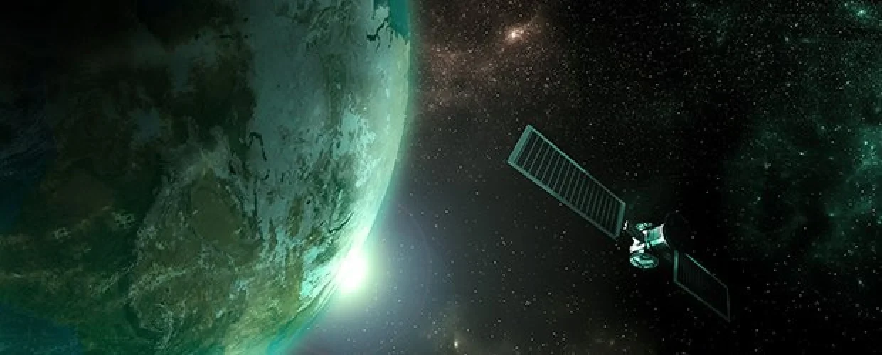
What is Remote Sensing?
In the field of GIS, remote sensing uses sensors which are installed on satellites or mounted on aircraft or drones so that they can take measurements on the earth. They collect images which are manipulated and analyzed for a deeper understanding of various geographical features, from land vegetation and chemicals in the atmosphere to wind speed and electromagnetic radiation.1,2
Remote sensing is possible because every object has its own spectral signature, which is the amount of reflected energy in a certain wavelength within the electromagnetic spectrum (EMS). This reflected energy is dependent on the object’s chemical composition.
How Remote Sensing Acquires Data
Remote sensors are typically either active or passive. They use detectors to record energy transmitted by electromagnetic radiation. They differ in terms of the wavelengths (spectral bands) that they operate in, whether they emit radiation or detect it, and what they can measure.
Active sensors include an energy source, which is sent to the object, and the reflected energy is then measured. This is similar to a camera flash. Most active sensors use the microwave wavelength, which can usually penetrate the atmosphere.
Other examples of active remote sensors include:
LiDAR
The Light Detection and Ranging Sensor (LiDAR), using laser radar, transmits a light pulse. It then measures reflected or backscattered light with a receiver that is made with sensitive detectors. From the time between light pulses and the speed of light, the object’s distance can be calculated.
Laser Altimeter
This uses the LiDAR sensor to measure the height of a platform above a surface (for example, the Mars Global Surveyor). In doing this, one can determine the surface’s topography.
Radar
A Radio Detection and Ranging Sensor (RADAR) uses its own electromagnetic energy to emit pulses of microwave radiation through a directional antenna. Energy reflects back to the sensor and this backscattered radiation is measured and timed, indicating the distance to the object. Through range and magnitude of reflected energy from different targets, the system can produce an image of the surface.
Scatterometer
This high-frequency microwave radar sensor measures backscattered radiation. It can be used to create maps of the surface wind speed and direction over an ocean surface.
Sounder
The sounder active remote sensor can measure atmospheric characters, such as precipitation, humidity, temperature and cloud composition. Active sounders will emit a pulse and then collect reflected radiance from the layers in the atmosphere.3
Passive sensors detect energy, in the form of radiation, that is emitted or reflected from the object or scene that is being observed. The most common source of radiation is from sunlight. Passive sensors operate in microwave, infrared, thermal infrared and visible wavelengths. They do not emit any radiation on their own. These sensors can measure physical properties such as land and sea temperatures. They can also measure the properties of vegetation, clouds and aerosols like dust, fog, smoke and air pollutants.4
Examples of passive remote sensors include:
Accelerometer
Respectively, the two types of accelerometers measure angular accelerations, which are changes in the rotation rate, and translational accelerations, changes in linear motions.
Radiometer
This detects and measures radiant energy in specific frequency bands. Radiometers are classified by the spectral band they cover, such as visible, microwave or infrared.
Hyperspectral radiometer
This is a highly specialized multispectral sensor that operates within visible, near-infrared and mid-infrared wavelengths in the electromagnetic spectrum. It can detect hundreds of narrow frequency bands within these ranges. Using ultra-high spectral resolution, it can discriminate between different target objects based on the spectral response.
Imaging radiometer
An imaging radiometer includes a scanner that provides a two-dimensional array of pixels, which produces an image. The scanning can be mechanical or electronic, using a detector array.
Spectroradiometer
This type of radiometer measures radiation intensity in multiple wavelengths (spectral bands). In many cases, it provides high-spectral resolution to remotely sense various geophysical parameters.
Sounder
This remote sensor measures vertical distributions of air temperature, barometric pressure, wind velocity, solar radiation and other atmospheric parameters, using multispectral information. Passive sounders collect emitted and reflected radiance from the surface.
Spectrometer
A spectrometer detects, measures and analyzes the spectral (frequency) content of reflected electromagnetic radiation. For spectral discrimination, imaging spectrometers use prisms or gratings that disperse the radiation.3
What Is Remote Sensing Used For?
Remote sensing is a technology found across diverse fields in virtually every area of modern life. The traditional and best-known uses for remote sensors are weather forecasting and mapping services like Google Earth. Remote sensors have been used to study biodiversity and changes in the environment, manage resources and track natural disasters.5
In the business world, remote sensing applications can count cars in a parking lot to predict the earnings and market share of a retail store. Agricultural industries can map soil types to better maintain food security for a growing population. Remote sensing applications can also be used to detect pedestrians, bicyclists, street signs and road hazards for autonomous vehicles (using LiDAR).6
Remote sensing is used extensively in emergency preparedness and disaster recovery. Firefighters use data from remote sensors to plan their deployment during a wildfire. Remote sensors help first responders search for aircraft after a crash, and they can be used to detect oil spills and speed up recovery efforts. They’re also used to track refugees to enable more efficient aid delivery in times of humanitarian crises.6
Remote sensing technology helps us to learn more about our world. With remote sensors, researchers can better understand poverty through the study of natural resources, agricultural use and environmental factors. Archeologists have used remote sensors to unearth ancient Mayan, Egyptian and other archaeological sites.6 Remote sensors also help monitor the health of the earth.7
The Future of GIS Remote Sensing
GIS and remote sensing technologies are experiencing exponential growth. In 2018, the global GIS market was worth $10.8 billion, which is predicted to nearly double by 2024.8 Future technologies include 3D virtual reality geographic information systems (VRGIS) for city planning and urban development. It is projected there will be increased demand for GIS applications to map real estate properties, assess air quality, handle wastewater treatment, map climate change and analyze food production sources. This explosive growth will create exciting, lucrative careers in GIS technology, where highly skilled professionals will lead discovery and innovation.
Use Your Skills at the Forefront of Evolving Technology.
Advance your career while helping to find solutions to the world’s greatest challenges. Kent State’s online Master of Geographic Information Science will prepare you for a rewarding GISc career, with a flexible online program that’s designed for working professionals. Graduate in as little as two years with the knowledge and expertise required for leadership in GIS technology.
Sources:
- Retrieved on June 8, 2020 from geospatialworld.net/blogs/overview-of-gis-history/
- Retrieved on June 3, 2020 from gisgeography.com/remote-sensing-earth-observation-guide/
- Retrieved on June 4, 2020 from earthdata.nasa.gov/learn/remote-sensors
- Retrieved on June 4, 2020 from earthobservatory.nasa.gov/features/RemoteSensing/remote_08.php
- Retrieved on June 4, 2020 from oceanservice.noaa.gov/facts/remotesensing.html
- Retrieved on June 5, 2020 from gisgeography.com/100-earth-remote-sensing-applications-uses/
- Retrieved on June 5, 2020 from esa.int/Applications/Observing_the_Earth/Copernicus
- Retrieved on June 8, 2020 from psmarketresearch.com/press-release/global-geographic-information-system-market


